In the previous year, Shenzhen University has continuously enhanced the high-quality development of scientific research. New breakthroughs have been achieved in high-level scientific research projects, high-level academic achievements have climbed to new altitudes, and new performance have been made in the construction of high-level scientific research platforms and think tanks. We have comprehensively boosted our capacity to serve regional economic and social development and national strategies.
Recently, Guangdong Provincial Department of Science and Technology announced the list of 2022 Science and Technology Awards. In 2022, our university applied for 58 items of Guangdong Provincial Science and Technology Awards as the first completed unit, all of which were qualified for a competition. In the end, we won 12 awards as the first completed unit, with a winning rate of 20.7%, which was higher than the provincial average. Among them, there were 1 first prize, 8 second prizes and 3 youth prizes. In the aspect of total prizes awarded, it has reached a new altitude in our university’s history. In addition, as a participating unit, Shenzhen University also won two second prizes.
Among them, “Key Technology and Application of 3D Cadastral” won the first prize of the Science and Technology Progress Award.


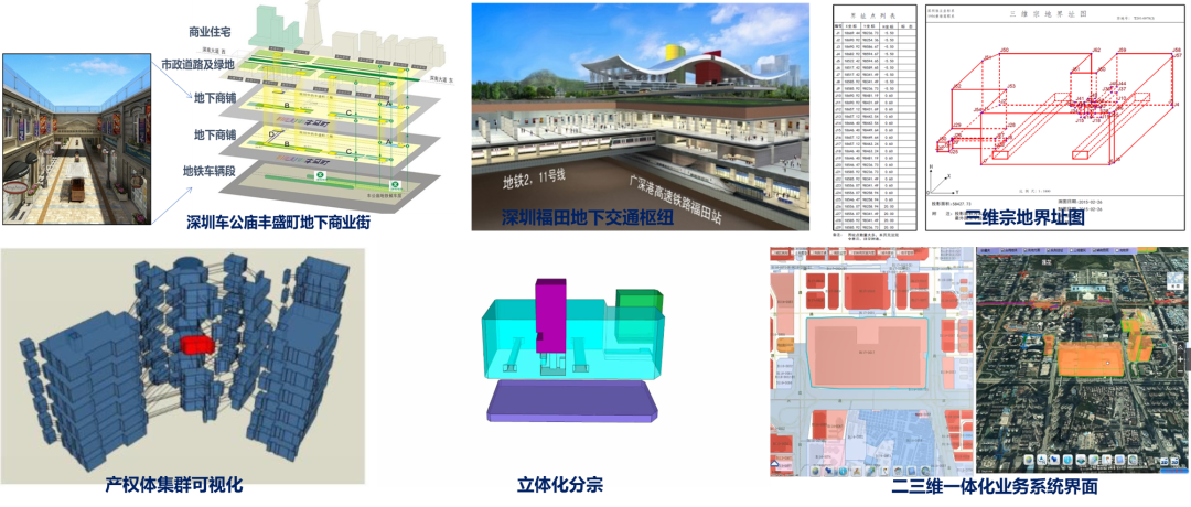
With the rapid advancement of industrialization and urbanization, the contradiction between human and land has become increasingly prominent, and the three-dimensional development and utilization of land resources has become a trend. Three-dimensional utilization breaks through the basic premise of two-dimensional cadastre, and the subject of property rights presents the characteristics of diversification (heterogeneity) in the vertical direction. It is an important technical demand in the process of contemporary urbanization to study three-dimensional cadastre and solve the technical problems of three-dimensional real estate right management brought about by three-dimensional utilization.
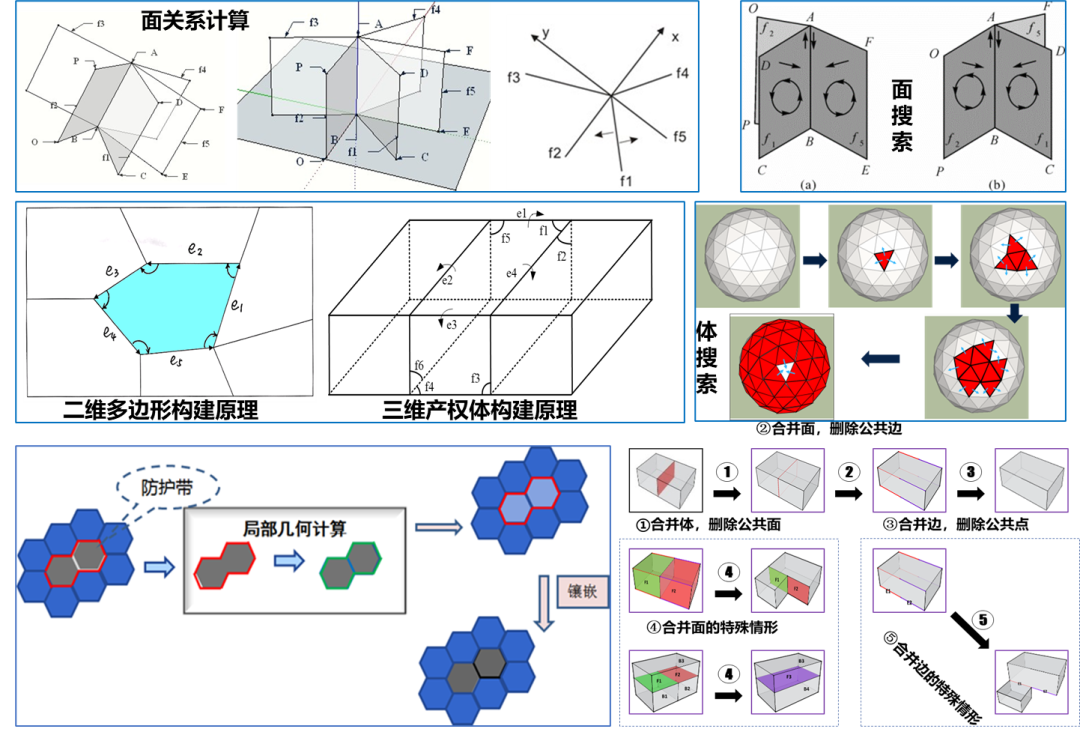
This project proposed the concept of three-dimensional property right body and a unified data model integrating two or three dimensions, which solved the problems of automatic construction of three-dimensional cadastral property right body and automatic maintenance algorithm of three-dimensional topological relationship. A three-dimensional ownership certificate has been designed, so as to form a complete three-dimensional cadastral solution. A three-dimensional cadastral management information system has been developed and put into commercial application in Shenzhen as a pilot. The results of this project were the earliest three-dimensional cadastral research achievements to enter practical application in the world.

